


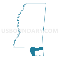
South Region--Pearl River, Hancock, George & Stone Counties PUMA, Mississippi
About
Outline

Summary
| Unique Area Identifier | 193269 |
| Name | South Region--Pearl River, Hancock, George & Stone Counties PUMA |
| State | Mississippi |
| Area (square miles) | 2,303.14 |
| Land Area (square miles) | 2,208.80 |
| Water Area (square miles) | 94.33 |
| % of Land Area | 95.90 |
| % of Water Area | 4.10 |
| Latitude of the Internal Point | 30.69316800 |
| Longtitude of the Internal Point | -89.28053110 |
Maps

Graphs
Select a template below for downloading or customizing gragh for South Region--Pearl River, Hancock, George & Stone Counties PUMA, Mississippi


Neighbors
Neighoring Public Use Microdata Area (by Name) Neighboring Public Use Microdata Area on the Map
- Capital Region Planning Commission 7--Tangipahoa & Washington Parishes PUMA, LA
- Mobile County (Outer)--Prichard City, Tillmans Corner & Saraland City PUMA, AL
- Regional Planning Commission 1--St. Tammany Parish (Northwest) PUMA, LA
- Regional Planning Commission 2--St. Tammany Parish (Southeast) PUMA, LA
- Regional Planning Commission 9--St. Bernard, Jefferson (South) & Plaquemines Parishes PUMA, LA
- South Region--Forrest, Lamar, Marion & Perry Counties--Hattiesburg City PUMA, MS
- South Region--Harrison County--Gulfport & Biloxi Cities PUMA, MS
- South Region--Jackson County PUMA, MS
- South Region--Jones, Wayne, Covington, Greene & Jefferson Davis Counties PUMA, MS
Top 10 Neighboring County (by Population) Neighboring County on the Map
- Mobile County, AL (412,992)
- St. Tammany Parish, LA (233,740)
- Harrison County, MS (187,105)
- Jackson County, MS (139,668)
- Forrest County, MS (74,934)
- Pearl River County, MS (55,834)
- Lamar County, MS (55,658)
- Washington Parish, LA (47,168)
- Hancock County, MS (43,929)
- St. Bernard Parish, LA (35,897)
Top 10 Neighboring County Subdivision (by Population) Neighboring County Subdivision on the Map
- Tanner Williams CCD, Mobile County, AL (71,460)
- District 2, Harrison County, MS (44,647)
- District 5, Harrison County, MS (42,436)
- District 3, Harrison County, MS (34,309)
- District 5, Jackson County, MS (33,532)
- District 1, Harrison County, MS (31,234)
- District 4, Jackson County, MS (30,708)
- District 1, Jackson County, MS (28,313)
- Semmes CCD, Mobile County, AL (22,869)
- District 9, St. Tammany Parish, LA (17,093)
Top 10 Neighboring Place (by Population) Neighboring Place on the Map
- Bogalusa city, LA (12,232)
- Picayune city, MS (10,878)
- Bay St. Louis city, MS (9,260)
- Diamondhead CDP, MS (8,425)
- Waveland city, MS (6,435)
- Wiggins city, MS (4,390)
- Nicholson CDP, MS (3,092)
- Lucedale city, MS (2,923)
- Poplarville city, MS (2,894)
- Kiln CDP, MS (2,238)
Top 10 Neighboring Unified School District (by Population) Neighboring Unified School District on the Map
- Mobile County School District, AL (399,587)
- St. Tammany Parish School District, LA (233,740)
- Harrison County School District, MS (86,048)
- Jackson County School District, MS (49,652)
- Lamar County School District, MS (49,650)
- St. Bernard Parish School District, LA (35,897)
- Washington Parish School District, LA (34,936)
- Hancock County School District, MS (28,715)
- Picayune School District, MS (23,631)
- George County School District, MS (22,578)
Top 10 Neighboring State Legislative District Lower Chamber (by Population) Neighboring State Legislative District Lower Chamber on the Map
- State House District 74, LA (55,721)
- State House District 102, AL (50,860)
- State House District 76, LA (50,170)
- State House District 75, LA (44,623)
- State House District 95, MS (30,262)
- State House District 107, MS (29,901)
- State House District 114, MS (29,403)
- State House District 93, MS (28,717)
- State House District 108, MS (28,687)
- State House District 99, MS (26,927)
Top 10 Neighboring State Legislative District Upper Chamber (by Population) Neighboring State Legislative District Upper Chamber on the Map
- State Senate District 34, AL (155,435)
- State Senate District 12, LA (136,047)
- State Senate District 1, LA (89,479)
- State Senate District 51, MS (62,901)
- State Senate District 40, MS (62,702)
- State Senate District 43, MS (62,195)
- State Senate District 47, MS (58,112)
- State Senate District 45, MS (57,871)
- State Senate District 41, MS (56,638)
- State Senate District 46, MS (56,319)
Top 10 Neighboring 111th Congressional District (by Population) Neighboring 111th Congressional District on the Map
- Congressional District 4, MS (754,015)
- Congressional District 1, AL (687,841)
- Congressional District 1, LA (686,961)
- Congressional District 3, LA (637,371)
Top 10 Neighboring Census Tract (by Population) Neighboring Census Tract on the Map
- Census Tract 35.01, Harrison County, MS (9,451)
- Census Tract 303, Hancock County, MS (9,315)
- Census Tract 401.02, St. Tammany Parish, LA (9,083)
- Census Tract 402.01, Jackson County, MS (8,613)
- Census Tract 305, Hancock County, MS (8,425)
- Census Tract 106, Forrest County, MS (8,006)
- Census Tract 9507, Pearl River County, MS (7,716)
- Census Tract 401.02, Jackson County, MS (7,569)
- Census Tract 9505.02, Pearl River County, MS (7,562)
- Census Tract 9505.01, Pearl River County, MS (7,457)
Top 10 Neighboring 5-Digit ZIP Code Tabulation Area (by Population) Neighboring 5-Digit ZIP Code Tabulation Area on the Map
- 39466, MS (27,738)
- 39452, MS (26,964)
- 70427, LA (20,033)
- 39565, MS (19,453)
- 39429, MS (17,657)
- 39426, MS (16,301)
- 39520, MS (14,681)
- 39574, MS (13,613)
- 39571, MS (13,179)
- 70452, LA (13,163)